Virtual tour, you can move through the image with the mouse.
Schalkenmehrener MaarThe maar for swimming
The Schalkenmehrener Maar is the largest of the three Dauner Maar and a so-called double maar. It consists of the western maar lake and the eastern dry maar.
While the Gemündener Maar and the Weinfelder Maar are nutrient-poor deep lakes, the third Dauner Maar is clearly different. The western Schalkenmehrener Maar is a rather shallow maar lake and the silted eastern part of the Schalkenmehrener Maar is a dry maar. Great fen vegetation has developed here with pastures, sedge meadows and sedge meadows - a perfect habitat for various rare animal species, especially for wetland and water-bound bird species.
Info & Audio
- Coordinates: 50° 10´10´´ N / 06°51´29´´ E
- Altitude: 422 m
- Funnel diameter: 1,100 m
- Funnel depth: 90 m
- Lake diameter: 554 m (N-S) and 502 m (W-E)
- Lake depth: 21 m
-
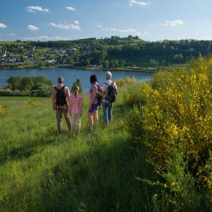
Wanderer am Schalkenmehrener Maar© Natur- und Geopark Vulkaneifel GmbH, Kappest
-

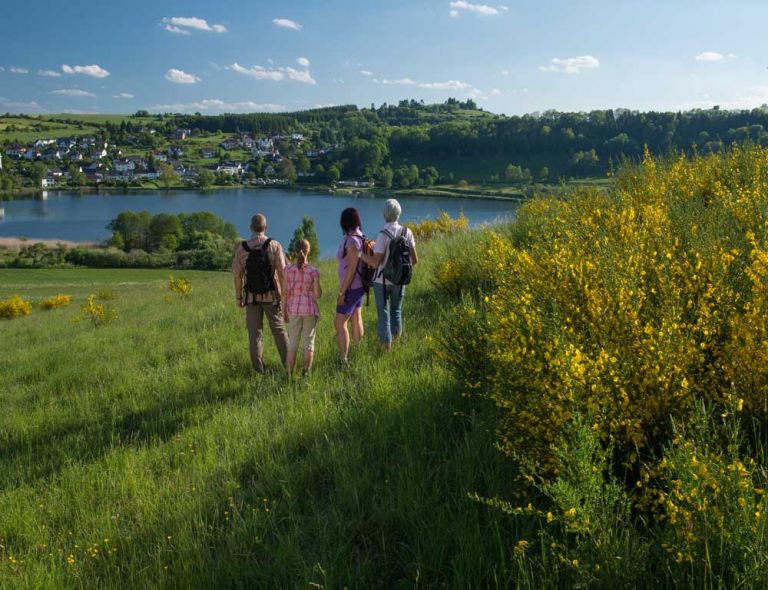
Wanderer am Vulcano-pfad am Schalkenmehrener Maar © Eifel Tourismus GmbH, D. Ketz
Geology
The Schalkenmehrener Maar, the Weinfelder and Gemündener Maar are lined up on a production fissure that runs from SE to NW and erupted as follows:
- Schalkenmehren dry maar,
- S-flat moor,
- S-Doppelmaar,
- Gemündener Maar
- and finally the Weinfelder Maar.
The time of their creation is estimated to be around 20,000 - 30,000 years before today (Würm Ice Age). The other two dry maars and the Hoher List cinder cone are older. The conveyor fissure breaks through the following Lower Devonian rock layers from SE to NW: Herdorf layers, Eckfeld layers and Reudelsterz layers, i.e. here again the transition from the Siegen stage to the Lower Ems stage occurs.
The older maars and the Hoher List cinder cone lie in the Herdorf layers. These consist of closely slated blue-black shales (lower dark layers), thick sandstone packages (Kürrenberg sandstone) and sandy shales (upper dark layers). The marine shales and siltstones of the Eckfeld layers are rich in fossils, while the Reudelsterz layers are described as weakly marine to brackish. They are composed of poorly sorted sand-siltstones, often with plant remains and carbonaceous layers. Maartuffs often cover the Lower Devonian in this area.
Location
The Schalkenmehrener Maar is located southeast of the district town of Daun.
Highlights nearby
- Gemündener Maar
- Weinfelder Maar
- Gemündener Maar Natural Outdoor Swimming Pool
- Schalkenmehrener Maar Natural Outdoor Swimming Pool
- Lookout Castle Dronketurm
- Home Weaving Museum
- Weinfelder Chapel
- Daun-Senheld Airfield
- Hoher List Observatory
The Schalkenmehrener Maar is point 26 of the German Volcano Road.
Hiking trails
around the Schalkenmehrener Maar
There is a lot to see in the region around the Schalkenmehrener Maar and a number of worthwhile destinations await hikers. The tours are not only interesting for nature lovers, culture fans also get their money's worth when visiting various museums.
Guided tours around the Schalkenmehrener Maar
Directions & Parking
There are several signposted parking spaces in Schalkenmehren.