Virtual tour, you can move through the image with the mouse.
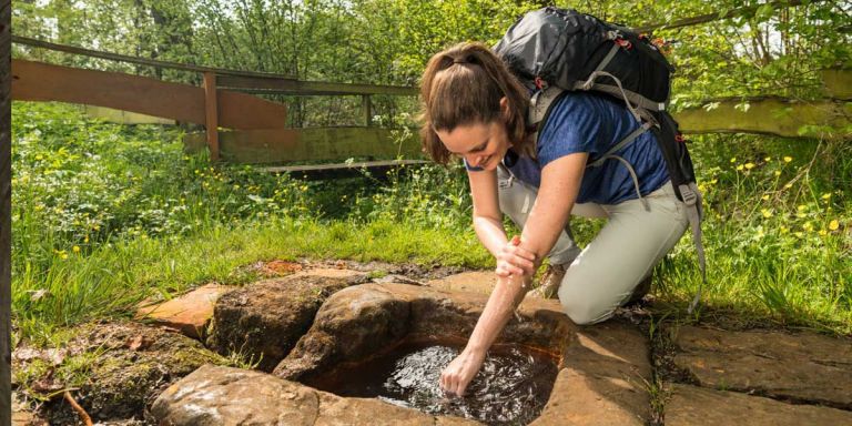
Steffelner Drees Source on the Eichholzmaar
The Steffelner Drees is located in the immediate vicinity of the Eichholzmaar in the German-Belgian nature park “Hohes Venn – Eifel”. Anyone who visits the Maar in Steffeln usually knows the attractive spring with its very original character. The special thing about Steffeln spring water is the low concentration of calcium and magnesium.
Info
- Coordinates: 50°16.331’N, 6°33.607’E
- Municipality/location: Steffeln
- Altitude: 491 m above sea level
- Water type: iron-containing calcium-magnesium-bicarbonate acid
- Water temp: 9.2 °C
-
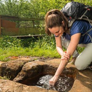
Steffelner Drees © Eifel Tourismus GmbH, D. Ketz
-
Steffelner Drees © Eifel Tourismus GmbH, D. Ketz
The fact that the water is rather low in calcium and magnesium compared to other mineral springs could have something to do with the length of time and the depth of the water. The longer and deeper a water is in contact with the minerals in the rock, the more minerals are dissolved in the water.
The amount of dissolved minerals is also related to the dissolved CO2 content. The more “aggressive” a water is, the more dissolving power it has. Ultimately, the type of rock also influences the dissolution process. Lime, for example, is more soluble than sandstone, but there are no limestone rocks in the subsoil.
Highlights nearby
- Steffeln Volcano Garden
- Duppacher Drees
- Eifel View Steffelberg
- Eichholz-Maar
- Eifel View „Auf Heilert“
- Roman Villa Complex Duppach
Hiking trails
There are great hiking trails nearby. Located on the volcano path from Jünkerath via Steffeln/Duppach to Gerolstein, hiking enthusiasts will find numerous routes for every taste and constitution.
-

Wanderwege im Gerolsteiner Land Vulkane, Maare und Dreese (Nordroute)
Rundweg um Steffeln zu den besonderen vulkanologischen Sehenswürdigkeiten um Steffeln und Auel
- Schwierigkeitsgrad:

- Strecke: 10,6 km -
- Dauer: 3 Std.
- Aufstieg: 110 hm -
- Abstieg: 110 hm
- Schwierigkeitsgrad:
-

Wanderwege im Gerolsteiner Land Vulkane, Maare und Dreese (Südroute)
Rundwanderweg durch die Landschaft und das Eichholzmaar rund um Duppach
- Schwierigkeitsgrad:
- Strecke: 10,5 km -
- Dauer: 3 Std.
- Aufstieg: 227 hm -
- Abstieg: 227 hm
- Schwierigkeitsgrad:
-

Guided tours
Directions
L25 in the direction of Steffeln, then change to the L24 in the direction of Duppach, park on the right side at the Eichholzmaar, follow the path around the maar and then continue along the stream to the Drees.