Virtual tour, you can move through the image with the mouse.
Eichholz Maar The renatured maar
People have demonstrably used the Maart Funnel since Roman times. It was drained several times and then refilled for fish farming. In 2007 and 2008 the Maarsee was renatured and filled with water again. For this purpose, the Gussbach, which flows through the dry maar, had previously been dammed. Today the Eichholz Maar is a popular place for rare water birds and reptiles.
Info
- Coordinates: 50°12´48´´ N / 06°58´10´´ E
- Altitude: 483 m above sea level Funnel diameter in E-W direction: approx. 125 m
- Funnel diameter in N-S direction: approx. 115 m
- Funnel depth: approx. 25 m
- Maar lake size today: approx. 1 ha
- Maar lake depth today approx. 2.20 m
- Laacher See tephra drilled at a depth of 12 m means approx. 13,000 years, possibly even 100,000 years, as the other maars in this region probably date back to the Old Quaternary.
-
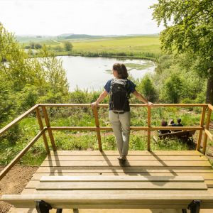
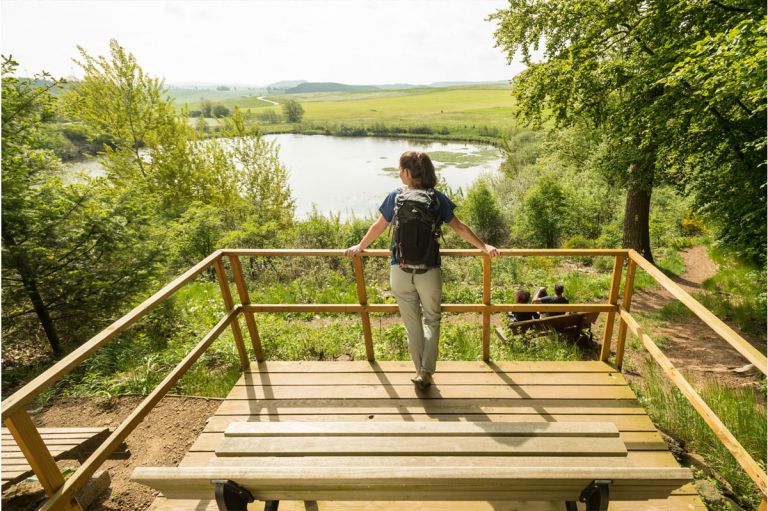
Blick vom Vulcanpfad auf das Eichholzmaar © Eifel Tourismus GmbH, D. Ketz
-
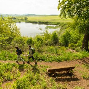
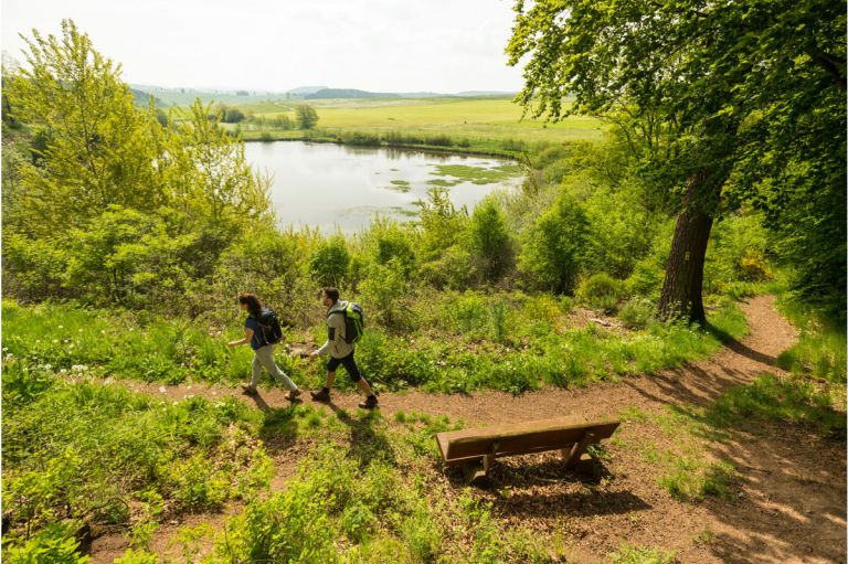
Vulcanpfad am Eichholzmaar © Eifel Tourismus GmbH, D. Ketz
Geology
The basement here consists of Lower Devonian sandstones from the Klerf layers of the Lower Ems stage (370 million years). They are interpreted as Wadden Sea deposits. On the NW edge of the maar there are still remains of river deposits made from the Buntsandstein (around 210 million years ago).
Special features
In 2004, the Institute for Physical Geography at the University of Frankfurt drilled a core drilling around 25 meters deep in the center of the maar, which was still dry at the time. In this drill core, a sequence of ice age debris deposits and younger, warm age lake deposits were documented. These lake deposits, which are approximately 16 meters thick, demonstrate the secure existence of a maar lake over a longer period of time. In the Tranchot map from 1811 from this region, the Eichholz Maar is still referred to as the Gussweiher filled with water.
Highlights nearby
- Steffeln Volcano Garden
- Steffelner Drees
- Eifel View Steffelberg
- Duppacher Drees
- Eifel View „Auf Heilert“
- Roman Villa Complex Duppach
- Small Museum Bolsdorf
- Historic Birgel Watermill
Hiking trails
around the Eichholz-Maar
The Eichholz Maar is one of the smaller maars in the Eifel, but has great hiking trails nearby. Located on the volcano path from Jünkerath via Steffeln/Duppach to Gerolstein, hiking enthusiasts will find numerous routes for every taste and constitution.
-

Wanderwege im Gerolsteiner Land Vulkane, Maare und Dreese (Nordroute)
Rundweg um Steffeln zu den besonderen vulkanologischen Sehenswürdigkeiten um Steffeln und Auel
- Schwierigkeitsgrad:

- Strecke: 10,6 km -
- Dauer: 3 Std.
- Aufstieg: 110 hm -
- Abstieg: 110 hm
- Schwierigkeitsgrad:
-

-

Wanderwege im Gerolsteiner Land Vulkane, Maare und Dreese (Südroute)
Rundwanderweg durch die Landschaft und das Eichholzmaar rund um Duppach
- Schwierigkeitsgrad:
- Strecke: 10,5 km -
- Dauer: 3 Std.
- Aufstieg: 227 hm -
- Abstieg: 227 hm
- Schwierigkeitsgrad:
Guided tours around the Eichholz-Maar
Directions & Parking
The Eichholzmaar is located on the L24 between Duppach and Steffeln. There is a hiking car park there.