
Duppacher DreesSpring under large pavilion
The Drees is located in the Duppacher Maar nature reserve. Its spring water comes from sand and siltstone layers of the Lower Devonian. It is relatively highly mineralized and has a particularly high carbon dioxide content.
Info
- Coordinates: 50°15.820’N, 6°33.087’E
- Municipality/location: Duppach
- Altitude: 476 m above sea level
- Water type: iron-containing sodium alkaline earth hydrogen carbonate acidic acid
- Water temp: 9.8 °C
-
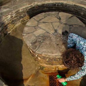
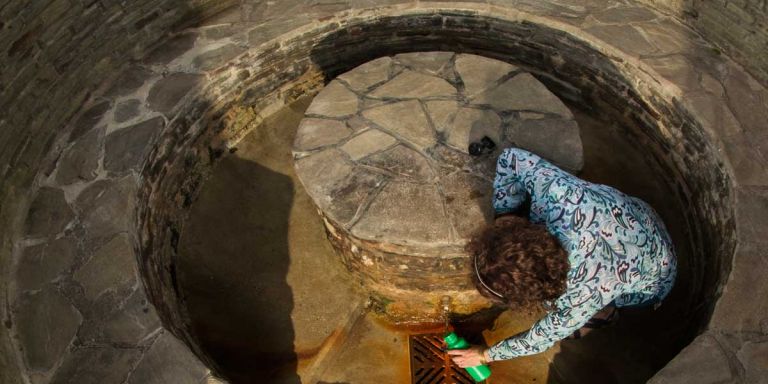
Duppacher Drees © Natur- und Geopark Vulkaneifel GmbH, Kappest
Because Duppacher Drees has a little more sodium chloride (table salt) dissolved in the water, it has a slightly salty taste. If you hold a burning candle in the deepest part of the well socket when there is no wind, it will go out because the heavy CO 2 gas that is pumped out with the water collects here. The spring area is covered by an elaborately designed spring temple.
Highlights nearby
- Steffeln Volcano Garden
- Steffelner Drees
- Eifel View Steffelberg
- Eichholz-Maar
- Eifel View „Auf Heilert“
- Roman Villa Complex Duppach
Hiking trails
Over hill and over stone - numerous hiking trails, including long-distance hiking trails, lead through the fields and forests of this region.
-

Wanderwege im Gerolsteiner Land Vulkane, Maare und Dreese (Südroute)
Rundwanderweg durch die Landschaft und das Eichholzmaar rund um Duppach
- Schwierigkeitsgrad:

- Strecke: 10,5 km -
- Dauer: 3 Std.
- Aufstieg: 227 hm -
- Abstieg: 227 hm
- Schwierigkeitsgrad:
Guided tours
Directions
L24 via Steffeln or L10 in the direction of Duppach, in the village turn onto Maifelderstraße, the Drees is near the Eichholzmaar and can be easily reached from the hiking car park on the L24.