
Helenen SourceWhere Gerolsteiner Sprudel is at home
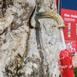
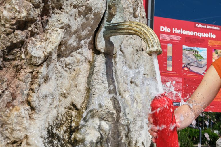
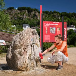
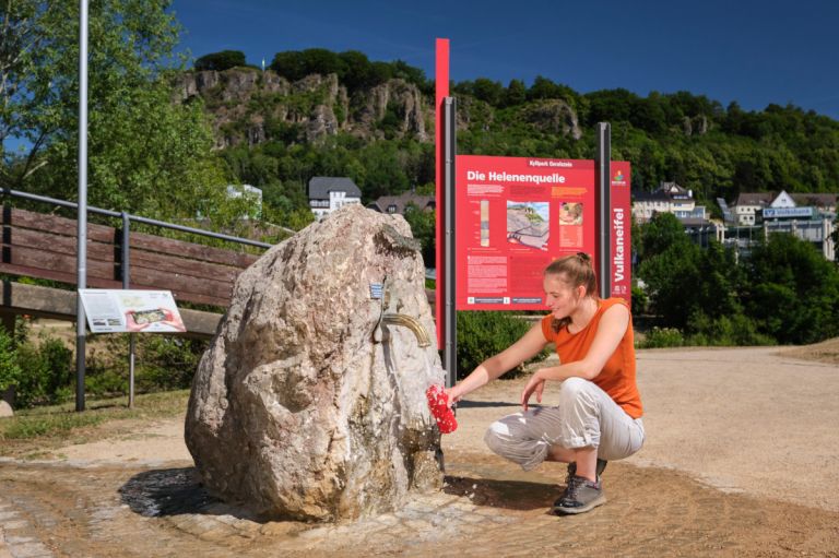
The Helenen Source is located in the middle of the Gerolstein spa park and looks quite elegant. It is labeled with pretty brass letters and the tap from which you can drink its water directly is also made of brass. The spring water comes from Middle Devonian limestone up to 98 meters deep.
Info
- Coordinates: 50°13.371’N, 6°39.442’E
- Municipality/location: Gerolstein
- Altitude: 359 m above sea level
- Water type: calcium-sodium-magnesium-bicarbonate acid
- Water temp: 13.0 °C
-
Helenenquelle © Eifel Tourismus GmbH, Dominik Ketz
-
Helenenquelle © Natur- und Geopark Vulkaneifel GmbH, Kappest
The Helenen Source is one of a number of mineral springs in the Gerolstein area and corresponds to the main type of Gerolstein mineral water: lots of calcium and magnesium and a good portion of carbon dioxide. The high calcium content of the spring becomes visible at the foot of the tap, where lime sinter (calcium carbonate) is deposited.
From the Eifel to the beverage markets
The Gerolsteiner Sprudel uses some of these springs that arise in the Gerolsteiner Kalkmulde industrially. While the Helenen Source has a flow rate of 5 liters per minute, the dimension of mineral water extraction is evident in the industrially used wells. On average, Gerolsteiner fills 3.5 million bottles per day.
Highlights nearby
- Museum Villa Sarabodis
- Papenkaule
- Buchenloch Cave
- Natural History Museum Gerolstein
- Eifel View Dietzenley
- Kasselburg With Eagle And Wolf Park
- Linden Source
- Gerolstein Indoor And Outdoor Swimming Pool
Hiking trails
There are several hiking trails in Gerolstein. Here we show you the most beautiful tours in the region.
-

-

Eifelsteig Etappe 09: Von Hillesheim bis Gerolstein
- Schwierigkeitsgrad:

- Strecke: 20,7 km -
- Dauer: 5:30 Std.
- Aufstieg: 444 hm -
- Abstieg: 512 hm
- Schwierigkeitsgrad:
-

-

Eifelsteig Etappe 10: Von Gerolstein nach Daun
- Schwierigkeitsgrad:

- Strecke: 23,9 km -
- Dauer: 6:30 Std.
- Aufstieg: 870 hm -
- Abstieg: 777 hm
- Schwierigkeitsgrad:
-

Directions
A1 exit Gerolstein, on the B410 to Gerolstein, turn into Kyllweg at the train station, park directly at the spa park, the Helenen Source is in the middle of the park.