Virtual tour, you can move through the image with the mouse.
Strohner Määrchen A raised moor in the Maar Valley
The Strohner Maar is one of the last raised bogs in the Eifel. It is quite small, hence its name: Fairy Tale. It is a dry moor and belongs to the nature reserve “Pulvermaar with Römerberg and Strohner Määrchen”.
Geology
In this Lower Devonian area, the gray siltstones, quartzitic sandstones and shales of the Eckfeld layers meet the disjointed rocks of the Elm stage, which also consist of sandstones and claystones. On the land surface these are covered by maart tuffs.
Info & Audio
- Coordinates: 50°10´48´´N/06°53´03´´E
- Altitude: 424 m above sea level
- Eliptical funnel: 210 x 140m
- Funnel depth:
- Funnel age: 25,000 years
-
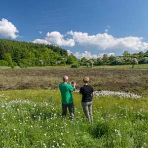
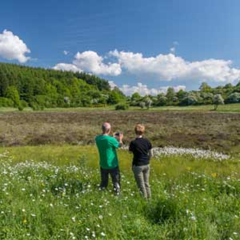
Strohner Määrchen © Natur- und Geopark Vulkaneifel GmbH, Kappest
-
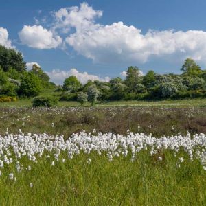
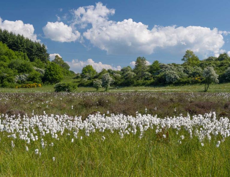
Wollgrasblüte am Strohner Määrchen © Natur- und Geopark Vulkaneifel GmbH, Kappest
Special features
Römerberg - Strohner Maar - Pulvermaar together form a volcanic group that sits on a SSE - NNW running fissure. First, the Strohner Maar exploded in the south. The next eruption created what is now a somewhat asymmetrical volcanic cone, Römerberg. At some point, its southern half slipped into the Strohner Maar and filled it. This is where the Strohner Määrchen, one of the last raised moors in the Eifel, was created. Last but not least, the Pulvermaar was created.
How did the moor in the maar come about?
Sphagnum moss settled on the constantly moist ground surface of the almost dry maar lake, which slowly formed a blanket. This constantly grows upwards and the lower, dead plant parts turn into peat in the absence of air. A raised bog is created when the mosses grow beyond the groundwater, bulge in the middle and only survive on rain. Typical moor plants are peat mosses and cotton and sedge grasses. With a diameter of a good 170 meters, the Strohner Maar is rather small and has an impressive vegetation diversity of around 250 plant species of rare raised and intermediate bog plants.
Highlights nearby
- Vulkano House Strohn
- Pulvermaar
- School Museum Immerath
- Immerather Maar
- Strotzbüscher Source
- Roman Grave
- Trautzberger Maar
- Lavabombe Strohn
- Holzmaar
- Dürres Maar
- Hetsche Maar
- Sangweiher
- Mürmes
Hiking trails
around the Strohner Määrchen
Plant lovers in particular will get their money's worth when it comes to the Strohner fairy tale. We hike around one of the last raised moors in the Eifel and move through nature that is second to none.
-

Andere Vulkaneifelpfade Maare-Pfad
Von Schalkenmehren bis Lutzerath
- Schwierigkeitsgrad:

- Strecke: 34,7 km -
- Dauer: 12 Std.
- Aufstieg: 657 hm -
- Abstieg: 672 hm
- Schwierigkeitsgrad:
-

HeimatSpuren Lavaweg Strohn
Diese Wanderung ermöglicht es sich mit dem Vulkanismus zu beschäftigen. Vorbei geht es am Trautzberger Maar und der Strohner Schweiz
- Schwierigkeitsgrad:

- Strecke: 20,5 km -
- Dauer: 5,5 Std.
- Aufstieg: 293 hm -
- Abstieg: 293 hm
- Schwierigkeitsgrad:
Guided tours around the Strohner fairy tale
Directions & Parking