Virtual tour, you can navigate through the image with your mouse.
Hinkelsmaar A Small Paradise for Rare Plants
Hinkelsmaar, in the true sense, is not a maar. It belongs to the Mosenberg-Meerfeld volcanic system and is a stratovolcano. In 1840, a tunnel was dug at the shallowest point of its rim to drain water from the crater lake.
After its drainage, the peat layers were mined as bedding for livestock stalls. Today, water is present in parts of the crater only after rainfall. It has developed into a typical peat bog. Hinkelsmaar and its adjacent areas are under nature protection.
Information & Audio
- Coordinates: 50°05´83´´N / 06°46´66´´E
- Elevation: 437 meters above sea level
- Crater Diameter: Approximately 107m north-south, 95m west-east
- Crater Depth: 10 meters
- Age of Volcanic Group: Approximately 80,000 years, with Hinkelsmaar representing the most recent eruption!
-
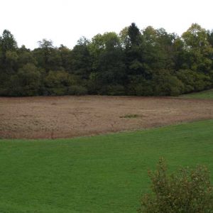
Blick auf das Hinkelsmaar © Natur- und Geopark Vulkaneifel GmbH, Kappest
-
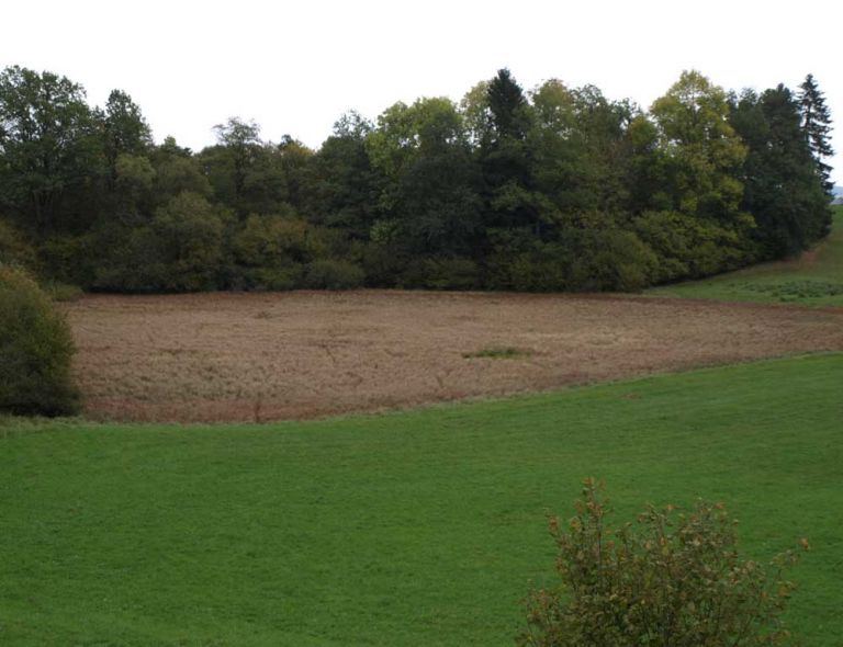
Blick auf das Hinkelsmaar © Natur- und Geopark Vulkaneifel GmbH, Kappest
Geology
Scientific observations suggest that where Hinkelsmaar is now visible, there was once a larger scoria cone with a crater. It was probably completely destroyed by the eruption of Hinkelsmaar. Scoria present on the eastern part of the northern crater rim supports this claim. It continues westward with three to five meters thick scoria and coarse-grained tuffs with lava bombs for over 20 meters. It is even possible that the scoria exposed in the parking lot on the north slope of Windsborn belongs to this scoria cone. Therefore, the north concave slope of Windsborn is part of the crater of this former scoria cone.
Special Features
Hinkelsmaar belongs to the Mosenberg-Reihenvulkangruppe. It is surrounded by a relatively shallow rim mainly composed of scoria and tuff. Within its ring, there was once a maar lake. Hinkelsmaar consists mainly of peat moss and a floating mat of grass, characterized as an intermediate bog. The appearance is dominated by the common cottongrass and the very rare slender sedge. They grow in the nutrient-rich areas between the floating mat. In summer, the yellow flowers of the bogbean and the white, fluffy fruit heads of the cotton grass create accents. In the peripheral water ring (Lagg), the bog arum thrives with its spiky fruits.
Location
Hinkelsmaar is located in Bettenfeld. Meerfeld, Manderscheid, and Deudesfeld are also nearby.
Highlights Nearby
- Windsborn Crater Lake
- Meerfelder Maar
- Volcano Adventure Park Mosenberg
- Observation Tower Landesblick
- Manderscheid Castles
- Maar Museum Manderscheid
- Dreisborn
Hiking Trails
around the Maar
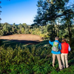
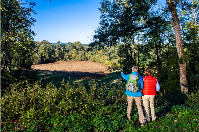
The nature reserve Hinkelsmaar is a popular destination for those interested in rare plants. Find the best walks, tours, and hiking trails around and to Hinkelsmaar here.
-

HeimatSpuren Kraterseen Mosenberg
Rundweg bei Bettenfeld, der viele geologische Highlights bereithält.
- Schwierigkeitsgrad:

- Strecke: 5,1 km -
- Dauer: 1:30 Std.
- Aufstieg: 135 hm -
- Abstieg: 135 hm
- Schwierigkeitsgrad:
-

HeimatSpuren Mühlenpfad
Eine beschauliche Wanderung durch die malerischen Salmauen bei Eisenschmitt.
- Schwierigkeitsgrad:
- Strecke: 6,7 km -
- Dauer: 1:45 Std.
- Aufstieg: 27 hm -
- Abstieg: 39 hm
- Schwierigkeitsgrad:
Guided Tours around the Maar
Directions & Parking
East of Bettenfeld on L16, there is a hiking parking lot between Windsborn Kratersee and Hinkelsmaar.