Virtual tour, you can move through the image with the mouse.
Dreisborn Buried for a long time
It wasn't until 1991 that this Drees in the Prembachtal was uncovered again. The spring socket was made with great craftsmanship from a single reddish sandstone block. This rock is found in a westerly direction, where it forms the ridges.
Info
- Coordinates: 50°04.062’N, 006°47.614’E
- Municipality/location: Bettenfeld
- Altitude: 340 m above sea level
- Water type: sodium magnesium hydrogen carbonate acidic acid
- Water temp.: 9.8 °C
-
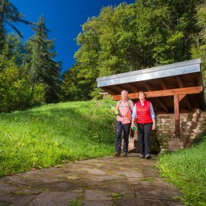
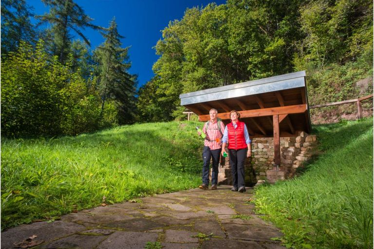
Dreisborn © Natur- und Geopark Vulkaneifel GmbH, Kappest
-
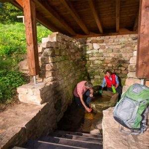
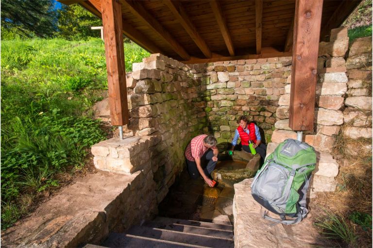
Quellstube Dreisborn © Natur- und Geopark Vulkaneifel GmbH, Kappest
The stone carving was most likely created in the 17th to 18th centuries. Originally the fountain was around 1.20 meters high. However, the version is not completely preserved and part of the upper part is missing. Demolishing the top edge and adding an outlet opening should probably increase the amount of water poured into the spring, as this depends on the water pressure and thus the height of the water outlet.
The spring room and the access to it were now in poor condition and were in danger of falling into disrepair. As part of a measure by the Vulkaneifel Nature and Geopark, the spring and the forecourt were redesigned and made accessible.
Highlights nearby
- Maar Museum Manderscheid
- Manderscheid Castles
- Meerfelder Maar
- Windsborn Crater Lake
Hiking trails
Experience an exciting hike on a scenic circular route with refreshment stops along the way.
-

Andere Vulkaneifelpfade VulkaMaar-Pfad
Rundtour westlich von Manderscheid
- Schwierigkeitsgrad:

- Strecke: 27 km -
- Dauer: 8,5 Std.
- Aufstieg: 1022 hm -
- Abstieg: 1022 hm
- Schwierigkeitsgrad:
Guided tours
Directions
A1 Manderscheid exit, take the L16 towards Manderscheid, at the roundabout turn onto the L46 towards Großlittgen. Between Manderscheid and Großlittgen, two forest paths branch off in a left-hand bend in the valley after a small bridge. Take the front one, park the car there and follow the path up. The Dreisborn is signposted with a hiking trail sign.