
Rothenbacher DreesA place steeped in history
The Rothenbacher Drees is a stop on the history route that offers many exciting insights into the culture and history of the region. It was renewed in 2015 with the support of the Vulkaneifel Nature and UNESCO Geopark.
Info
- Coordinates: 50°18.492’N, 6°53.284’E
- Municipality/location: Rothenbach
- Altitude: 444 m above sea level
- Water type: iron-containing magnesium hydrogen carbonate acidic acid
- Water temp.: 8.4 °C and 10.7 °C
-
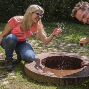
Rothenbacher Drees Wasserspritzer © Natur- und Geopark Vulkaneifel GmbH, Kappest
-

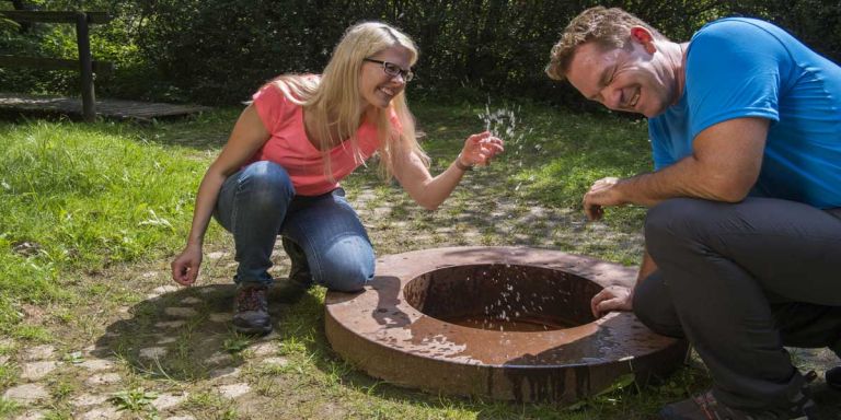
Rothenbacher Drees © Natur- und Geopark Vulkaneifel GmbH, Kappest
The town of Rothenbach, now attached to Kelberg, was first mentioned in writing in 1563. The place name probably goes back to the iron ocher formation of the source and the associated stream color. The mineralization is rather low compared to other mineral springs such as the neighboring Bodenbacher Drees. However, there is a relatively large amount of free carbon dioxide present. The CO2 bubbles that bubble through the water are evidence of volcanic processes deep in the earth. A special feature of the spring outlets, which are located close to each other, is the significantly different water temperature.
Highlights nearby
- Observation Tower "Eifel-Guck"
- Eifel View Hochkelberg
- Bodenbacher Drees
- Kelberg Outdoor Swimming Pool
- Afelskreuz Katzwinkel
- Gelenberger Source
- Eifel View Herrenseifen
- Mosbrucher Weiher
Hiking trails
Those interested in culture and history will particularly get their money's worth in this region. Let yourself be carried away into our wonderful nature and embark on hiking trails that provide you with a lot of knowledge.
-

Themenrundwege Geschichtsstraße Kelberg Vulkane, Wasser und Wissen
Rundweg um Rothenbach und Meisenthal, vorbei am Rothenbacher Drees mit Blick auf den Hochkelberg
- Schwierigkeitsgrad:

- Strecke: 5 km -
- Dauer: 1,5 Std.
- Aufstieg: 107 hm -
- Abstieg: 106 hm
- Schwierigkeitsgrad:
-

Themenrundwege Geschichtsstraße Kelberg Höfe, Häuser und Hütten
Rundweg westlich von Kelberg, vorbei am Rothenbacher Drees und der Gelenberger Mofette
- Schwierigkeitsgrad:

- Strecke: 15 km -
- Dauer: 4 Std.
- Aufstieg: 238 hm -
- Abstieg: 287 hm
- Schwierigkeitsgrad:
Directions
From the B257 change to the K87 towards Rothenbach, first onto the Bienenwiese street and then turn into Dreesweg, the Drees is on the right.