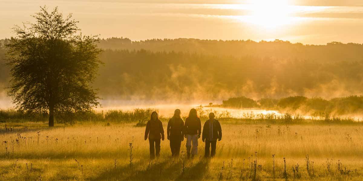
Wetlands
Larger wetlands are actually typical of flat lowlands and large river floodplains. In low mountain landscapes they are usually found rarely or only in small areas. Due to the relief, surface water drains away quickly in hilly landscapes.
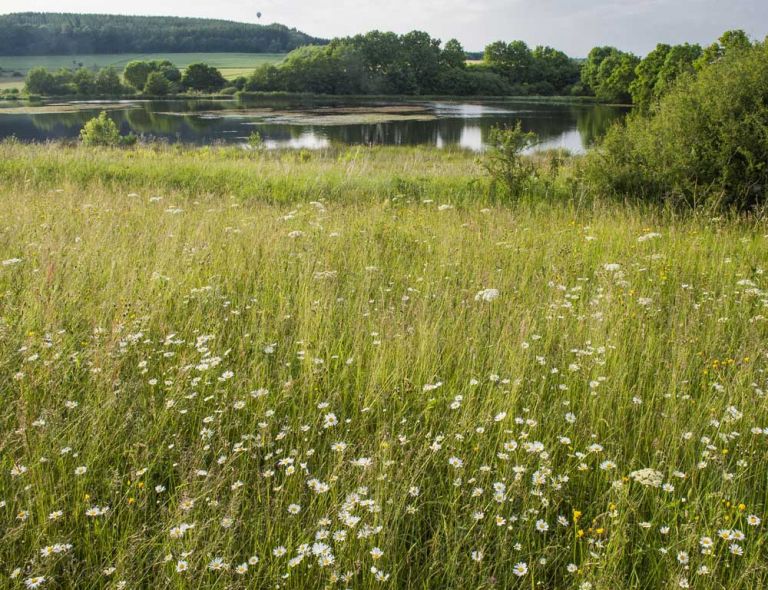
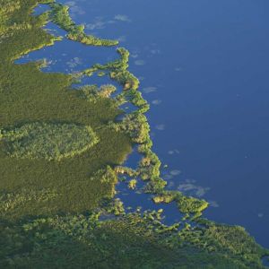
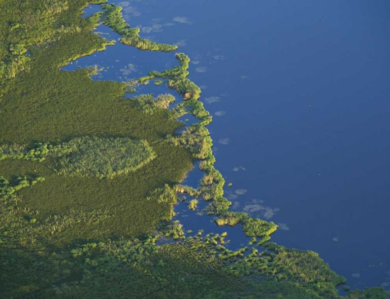
In the Vulkaneifel there are still some large and ecologically important wetlands. They are often located in maar depressions that are not filled with water, such as in the Dreiser Weiher, the Mosbrucher Weiher or the Kirchweiler Rohr. They can be found in silting up areas of ponds and lakes, such as at the Sangweiher between Udler and Schalkenmehren or at the Jungferweiher near Ulmen. Depending on the location and water supply, the range extends from areas that are waterlogged to permanently wet and springy. Complex landscapes with diverse plant communities can occur.
-
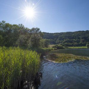
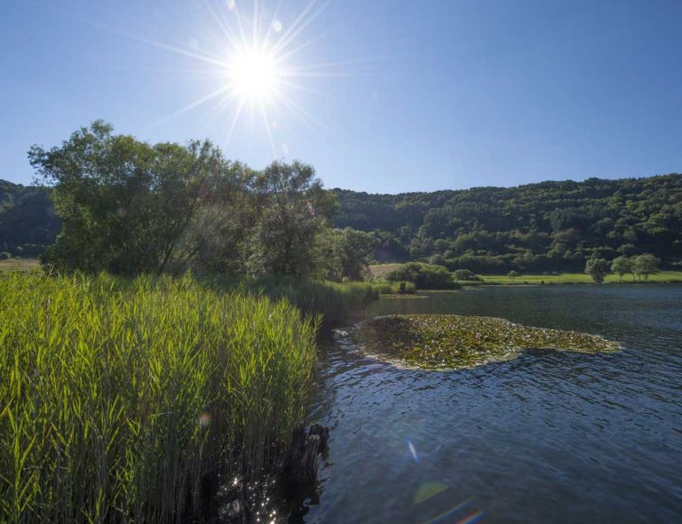
Seen und Weiher
-
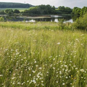
Seenwiesen
-
Seenlandschaften
Flower-filled Vulkaneifel - home to many species
Meadowsweet tall herbaceous meadows alternate with marsh marigold meadows, pipe grass meadows or forest rush swamps. Small and large sedges as well as reedbeds in combination with willow bushes testify to a great diversity of species. Extensive mowing or grazing often maintains diversity. Wetlands are of particular importance as bird habitats. Species such as reed buntings, reed warblers and whinchats breed here. With a bit of luck you can meet snipes, cranes and white storks during migration, and black storks use the small bodies of water as a feeding habitat. Attractive butterflies such as the violet and the edge-ringed fritillary as well as numerous amphibians also use these habitats.
Hiking trails
through the Kirchweiler Rohr wetland
-

Muße-Pfad Vulcano-Pfad
Rundtour östlich von Schalkenmehren
Blicke über den Gartenzaun ins Land der Maare und Määrchen. Verliere dich nicht im Detail, nimm Abstand, blicke über den Gartenzaun und sieh das Ganze!
- Schwierigkeitsgrad:

- Strecke: 26,2 km -
- Dauer: 16:42 Std.
- Aufstieg: 652 hm -
- Abstieg: 652 hm
- Schwierigkeitsgrad:
-

Themenrundwege Geschichtsstraße Kelberg Geheimnis Natur und Leben
Rundweg über Köttelbach, Sassen und Mosbruch, vorbei am Hochkelberg und Mosbrucher Weiher
- Schwierigkeitsgrad:

- Strecke: 10,4 km -
- Dauer: 3 Std.
- Aufstieg: 209 hm -
- Abstieg: 209 hm
- Schwierigkeitsgrad:
-

HeimatSpuren Ulmener Acht
Rundweg nördlich und südlich von Ulmen, über Meiserich und die Auderather Mühle
- Schwierigkeitsgrad:
- Strecke: 21 km -
- Dauer: 6 Std.
- Aufstieg: 220 hm -
- Abstieg: 246 hm
- Schwierigkeitsgrad: