
Üdersdorfer Drees
Older citizens say that Üdersdorfer Drees was caught before World War II. Many remember that as children they drew mineral water there so that they could bake pancakes made of buckwheat - in dialect “Heedeleschkoochen” - at home. The carbon dioxide-containing mineral water ensured that the dough was light. The water was also often drunk as a refreshing drink when harvesting hay.
Info
- Coordinates: N 50° 9' 36.8964 E 6° 49' 18.0516
- Municipality/location: Üdersdorf
- Altitude: 368 m above sea level. NN
- Water type:
- Water temp:
-
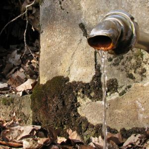
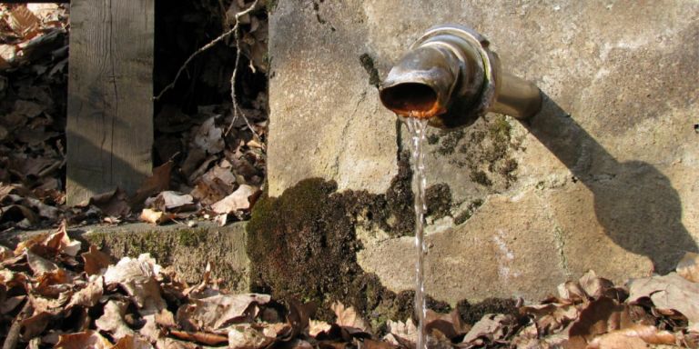
Üdersdorfer Drees © Natur- und Geopark Vulkaneifel GmbH, Müller
-
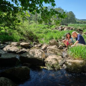
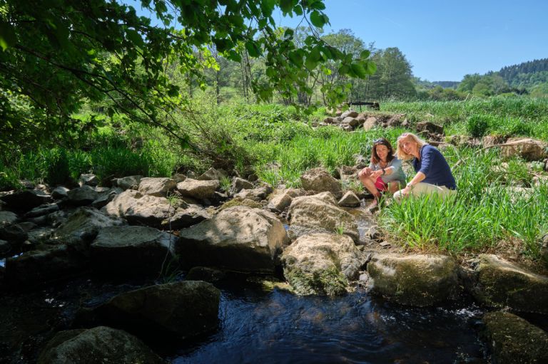
Liesertal nahe des Üdersdorfer Dreeses © Natur- und Geopark Vulkaneifel
Our ancestors, the Celts, called these springs “Thriasan”. Today these bubbling springs are called “Drees” by the Eifel residents.
Highlights nearby
- Gemündener Maar
- Schalkenmehrener Maar
- Niederstadtfelder Drees
- Daun Wildlife And Adventure Park
- Wallender Born "Brubbel"
Hiking trails
Over hill and over stone - numerous hiking trails, including long-distance hiking trails, lead through the fields and forests of this region.
-

HeimatSpuren Wasser- und Felsenweg
Rundweg nördlich von Üdersdorf über die Basaltfelsen der Löhley zum belebenden Mineralwasser im Liesertal
- Schwierigkeitsgrad:

- Strecke: 13,5 km -
- Dauer: 4 Std.
- Aufstieg: 310 hm -
- Abstieg: 310 hm
- Schwierigkeitsgrad:
-

Entlang von Lieser, Endert und Salm Lieserpfad Etappe 2 Daun - Manderscheid
Vorbei an den Dauner Maaren führt der zweite, konditionell anspruchsvollere Teil des Lieserpfades bis auf die Höhen von Manderscheid. Genießen Sie die Stille im Tal der Lieser!
- Schwierigkeitsgrad:

- Strecke: 18,3 km -
- Dauer: 5:31 Std.
- Aufstieg: 247 hm -
- Abstieg: 319 hm
- Schwierigkeitsgrad:
-

Eifelsteig Etappe 11: Von Daun bis Manderscheid
- Schwierigkeitsgrad:
- Strecke: 23,4 km -
- Dauer: 7:00 Std.
- Aufstieg: 564 hm -
- Abstieg: 652 hm
- Schwierigkeitsgrad:
Directions
From Daun follow the L46 in a southerly direction. Follow the road through the town of Gemünden. In Weiersbach, park on the left side of the street and cross the Lieser at the Kapellenstrasse bridge. From there, follow the path along the Lieser in a southerly direction towards Trittscheid. The Sauerbrunnen is reached after around 900 m.