
The high altitudes of the Eifel reach up to 700 meters above sea level and are the headwaters of many Eifel streams such as Salm, Lieser, Alfbach, Ahbach or Uessbach.
These birthplaces of streams and rivers were often also preferred settlement sites for humans. Many place names in the Vulkaneifel such as Bereborn, Wallenborn, Salm or Pützborn have the springs in their names.
A typical natural Vulkaneifel spring is a seepage spring with several outlet sources in a larger source area. These can be in the forest or often in grassland-dominated open land. But springs are not just places where groundwater emerges from the earth. They are always a habitat for a rare community of plants and animals.
In areas with Quaternary volcanism, mineral springs can occur, which often appear in the Volcanic Eifel as so-called Dreese. Some of these mineral springs and the additional wells such as those in Dreis, Daun or Gerolstein developed into important economic locations with natural mineral waters exported worldwide.
-
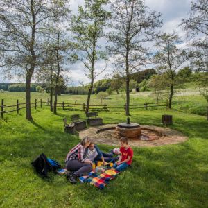
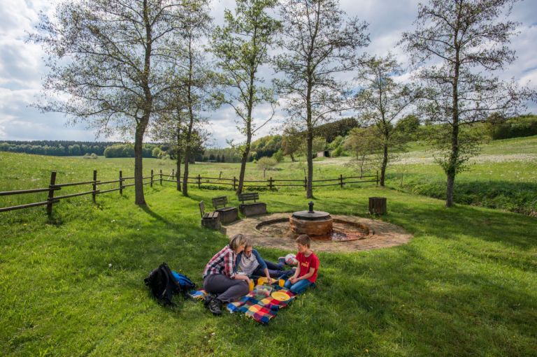
Picknick at a mineral water spring, "drees" © Natur- und Geopark Vulkaneifel, Kappest
-
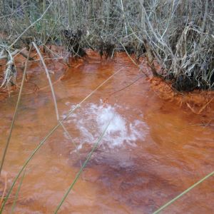
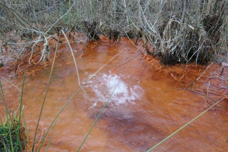
A natural mineral water spring called "drees" © Natur- und Geopark Vulkaneifel, Kappest
-
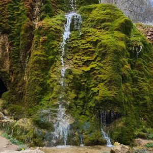
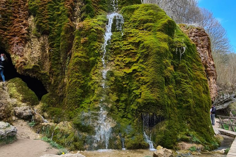
The Waterfall Dreimühlen © Natur- und Geopark Vulkaneifel, Kappest
The Lieser - an important left tributary of the Moselle
The Lieser rises west of Boxberg at 564 meters above sea level. The typical seepage spring is located in a spring trough within a grassland-shaped, open landscape. Several spring outlets gather here to form a natural spring stream. The hollow is characterized by species-rich grassland: poor and fresh meadows lie in the drier slope areas and wet and moist meadows in the depressions and along the spring streams. Attractive plant species such as marsh marigolds, marsh yarrow, snake knotweed and bog trefoil find their place here. Pipe grass, rushes and ledges are added as moisture indicators. The “spring corridor” habitat is also important for specialized amphibians, butterflies and birds.
Hiking trails
through headwaters
-

HeimatSpuren Quellenweg
Rundweg um Dreis-Brück und Dockweiler, über die Vulkania Heilquelle und den Dreiser Weiher
- Schwierigkeitsgrad:

- Strecke: 15 km -
- Dauer: 4 Std.
- Aufstieg: 269 hm -
- Abstieg: 269 hm
- Schwierigkeitsgrad:
-

Entlang von Lieser, Endert und Salm Lieserpfad Etappe 1 Boxberg - Daun
Einen leichten Einstieg in den Lieserpfad bietet die Etappe von der Quelle in Boxberg bis zur Kurstadt Daun. Die Schönheit des Weges zeigt sich bereits auf diesem ersten Teilstück.
- Schwierigkeitsgrad:
- Strecke: 15,4 km -
- Dauer: 4:10 Std.
- Aufstieg: 138 hm -
- Abstieg: 276 hm
- Schwierigkeitsgrad:
-

Themenrundwege Geschichtsstraße Kelberg Vulkane, Wasser und Wissen
Rundweg um Rothenbach und Meisenthal, vorbei am Rothenbacher Drees mit Blick auf den Hochkelberg
- Schwierigkeitsgrad:

- Strecke: 5 km -
- Dauer: 1,5 Std.
- Aufstieg: 107 hm -
- Abstieg: 106 hm
- Schwierigkeitsgrad:
-

Muße-Pfad Hochkelberg Panoramapfad
Wandern auf den Meilensteinen der Geschichte Geh auf Zeitreise mit dem Goldenen Wagen, steig auf, lass dich mitreißen, nimm teil du folge dem Rad der Geschichte(n)
Von Niederehe - Kelberg - Ulmen
- Schwierigkeitsgrad:

- Strecke: 39,4 km -
- Dauer: 13 Std.
- Aufstieg: 606 hm -
- Abstieg: 571 hm
- Schwierigkeitsgrad: