Virtual tour, you can move through the image with the mouse.
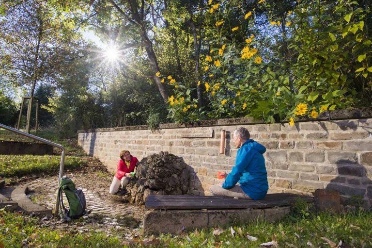
Wallenborner DreesIt's finally bubbling again
For many decades, a well-used sour fountain supplied the people of Wallenborn with fresh spring water. Unfortunately, almost 20 years ago, the Drees was so damaged during renovation work that its water was no longer drinkable. He only lived a sad shadowy existence until Wallenborn put an end to it.
Info
- Coordinates: 50°09.325’N, 6°42.957’E
- Municipality/location: Wallenborn
- Altitude: 425 m above sea level
- Water type: sodium-calcium-magnesium-bicarbonate-sourling
- Water temp.: 9.8 °C
-
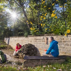
Wallenborner Drees mit Leuten © Natur- und Geopark Vulkaneifel GmbH, Kappest
-
Wallenborner Drees © Natur- und Geopark Vulkaneifel GmbH, Kappest
Strong pensioners took pity and took action. Since the place is rich in carbonated springs, they first renovated the Felddrees on the outskirts of the town - as a kind of dress rehearsal - which has since then offered refreshment especially to hikers and tourists. However, the restoration of the old Sauerbrunnen turned out to be a little more complex than initially planned.
Reward of the effort
It took many attempts and half a year to locate and redefine the original source from the numerous bubbling rivulets. The reward for the effort is the Wallenborner Drees, which is now bubbling in new splendor and is now being used extensively again - especially by the children of the village.
Highlights nearby
- Wallender Born "Brubbel"
- Niederstadtfelder Drees
- Freudenkoppe Castle Ruins
- Daun Wildlife And Adventure Park
- Mousetrap Museum
Hiking trails
In the network of hiking trails around Wallenborn, those who want to hike will certainly find a number of routes that will give them great pleasure. Enjoy the wonderful nature on one of our routes selected for you.
-

HeimatSpuren Wallenborner Weg
Rundweg südlich von Wallenborn mit Kaltwasser-Geysir und schönen Weitblicken
- Schwierigkeitsgrad:

- Strecke: 5 km -
- Dauer: 1,5 Std.
- Aufstieg: 121 hm -
- Abstieg: 129 hm
- Schwierigkeitsgrad:
-

Andere Vulkaneifelpfade Hinterbüsch-Pfad
Von Üdersdorf nach Meerfeld
- Schwierigkeitsgrad:

- Strecke: 34,1 km -
- Dauer: 11 Std.
- Aufstieg: 862 hm -
- Abstieg: 700 hm
- Schwierigkeitsgrad:
Guided tours
Directions
B257 in the direction of Wallenborn, there turn from the main street into Schulstraße, turn right at the junction and follow the dead end to Drees.