Virtual tour, you can move through the image with the mouse.
Jungferweiher A dry maar that has been flooded again
North of the Ulmener Maar lies the Jungferweiher. It fills a shallow depression sloping towards the south. This previously silted up, older dry maar was flooded again in 1942 by damming the Nollenbach.
The Jungferweiher is now around 170,000 square meters in size and has a depth of 0.8 meters. Its water flows into the Ulmener Maar and is used to produce drinking water in the Cochem-Zell district. This water from the Jungferweiher has been technically treated since 1989, eliminating the phosphorus from agriculture. The Jungferweiher is now protected along with the Ulmener Maar and is known for its abundance of migratory birds.
Info
- Coordinates: 50°13´04´´N / 06°58´50´´E
- Altitude: 428 m above sea level
- Trockenmaar diameter: approx. 1,500 m
- Drilled maar sediments: approx. 128 m (former lake depth!)
- Maar age: > 130,000 years, probably even older
Today's lake
- Lake diameter: approx. 870m in NW-SE direction and approx. 340m in W-E direction
- Lake surface: 170,000 m²
- Lake content: 250,000 m³
- Lake depth: 0.8m (average depth)
-
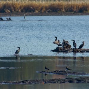
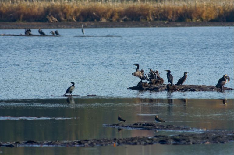
Kormorane am Jungferweiher © Natur- und Geopark Vulkaneifel GmbH, Kappest
-
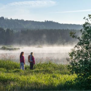
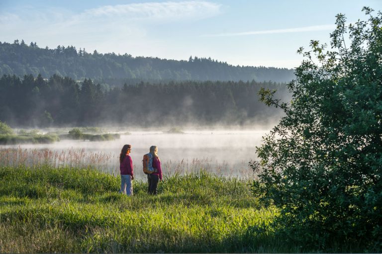
Nebel am Jungferweiher © Natur- und Geopark Vulkaneifel GmbH, Kappest
Geology
The maar lies exactly on a SE-NW fault in the basement. This is the Lower Devonian, unstructured elm stage with sandstones, siltstones and shales.
Special features
A number of endangered bird species breed on the banks rich in rushes at the Jungferweiher. You can find meadow pipits there as well as common snipes. Ospreys can also be observed. There is a bird watching station on the western bank, from here you can easily observe the birds without disturbing them.
Location
Highlights nearby
- Ulmener Maar
- Ulmener Castle Ruins
- Eifel View Kreuzberg
- Eifel View Höchstberg
- Celtic Wall Steineberg
- Royal Organ
- Nostalgic Uersfeld
Hiking trails
around the Jungferweiher
You shouldn't miss a hike on the approximately three kilometer long circular path around the Jungferweiher, especially during the bird migration periods in spring and autumn.
-

-

HeimatSpuren Ulmener Acht
Rundweg nördlich und südlich von Ulmen, über Meiserich und die Auderather Mühle
- Schwierigkeitsgrad:

- Strecke: 21 km -
- Dauer: 6 Std.
- Aufstieg: 220 hm -
- Abstieg: 246 hm
- Schwierigkeitsgrad:
-

Muße-Pfad Hochkelberg Panoramapfad
Wandern auf den Meilensteinen der Geschichte Geh auf Zeitreise mit dem Goldenen Wagen, steig auf, lass dich mitreißen, nimm teil du folge dem Rad der Geschichte(n)
Von Niederehe - Kelberg - Ulmen
- Schwierigkeitsgrad:

- Strecke: 39,4 km -
- Dauer: 13 Std.
- Aufstieg: 606 hm -
- Abstieg: 571 hm
- Schwierigkeitsgrad:
Guided tours
Directions & Parking
The best place for guests to park is in a parking lot that can be reached via the street “Am Jungferweiher”. The city of Ulmen also offers numerous parking spaces at the Alter Postplatz or the market square. From here, however, it is a short walk to the banks of the water.