Virtual Tour: You can navigate through the image with your mouse.
Trautzberger Maar Smallest Volcanic Lake in the Eifel. And the Youngest.
It may sound confusing at first, but it's quite simple. Trautzberger Maar in the Wartgesberg nature reserve was drained in the 1960s to create new agricultural land. However, in 2014, efforts began to rehydrate the maar, and it has since become a small lake once again.
Information & Audio
- Coordinates: 50° 06´ 35´´ N / 06° 56´ 43´´ E
- Altitude at the center of the crater: 395 m
- Maar Age: > 20,000 years (Ice Age!)
- Current crater diameter: approximately 270 m
- Wetland area on the maar floor: approximately 75 m in diameter!
- Crater depth: approximately 20-25 m
-
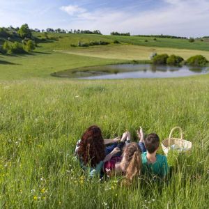
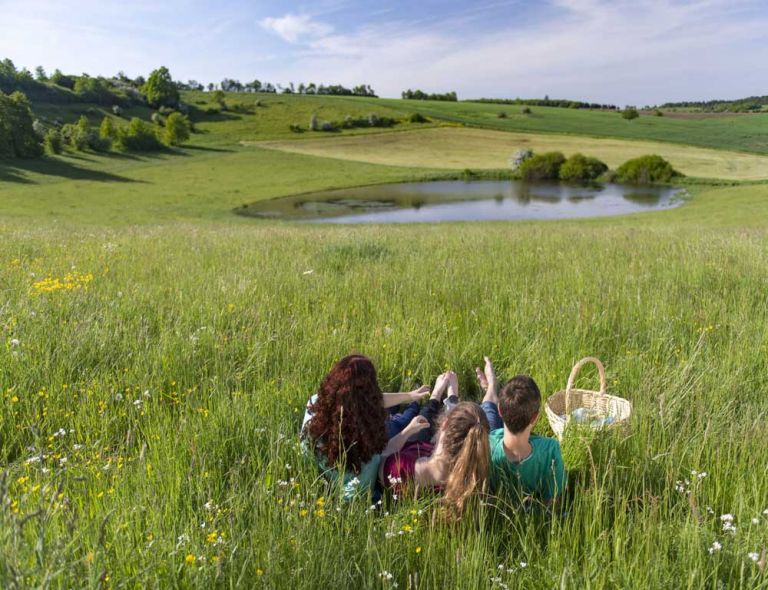
Picknick am Trautzberger Maar © Natur- und Geopark Vulkaneifel GmbH, Kappest
-
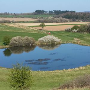
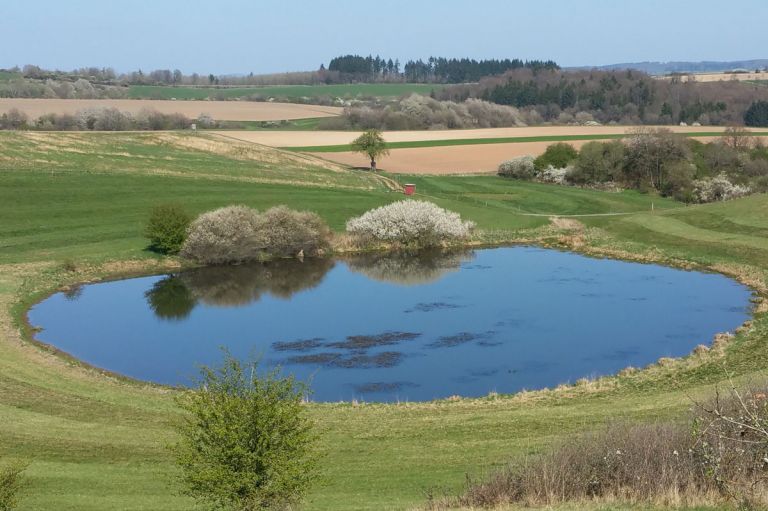
Blick auf das Trautzberger Maar © Natur- und Geopark Vulkaneifel GmbH, I. Sartoris
Geology
The maar has cut into the Bänderschieferfolge, which is a transitional layer between the lower Devonian Siegen and Unterems stages. It comes from the northeast, passing through Büchel and ending here in the Strohn area. The shale sequence is almost entirely overlaid by maar tuffs, which are red-colored here and contain reddish sandstone and shale fragments. They are overlaid by black basalt lapilli tuffs from the Wartgesberg volcanoes and, finally, by ashes from the Sprinker Maar, which various geological exposures in the area confirm. Ice wedge pseudomorphs have also been observed in the maar tuffs. With the different origins of the tuffs, this is evidence that this maar crater must have formed during the last Ice Age.
Special Features
At the northwest edge of the crater, the elevation measures 420 meters, while at the eastern edge, it is only 392 meters, resulting in a difference of 28 meters. This correlates well with a crater depth of approximately 20 to 25 meters. Trautzberger Maar opens up to the east and drains into the Diefenbach. This drainage was artificially created around 1820/30 to drain the maar for agricultural use. Prior to that, it was used as a fish pond.
Location
Trautzberger Maar is located north of the K26 and north of Trautzberg in a depression. The maar crater formed in a tiny side valley of the small Diefenbach stream, approximately 1.5 kilometers east of Strohn.
Highlights Nearby
- Lavabombe Strohn
- Volcano House Strohn
- Roman Grave Strotzbüsch
- Strotzbüscher Source
- Immerather Maar
- Strohner Määrchen
- Pulvermaar
- Museum Zum Alten Eisen
- School Museum Immerath
Hiking Trails
around Trautzberger Maar
Hikes and walks around Trautzberger Maar are as varied as in the entire Vulkaneifel region. Nowhere else does nature tell the hiker so many stories from the distant past.
-

HeimatSpuren Lavaweg Strohn
Diese Wanderung ermöglicht es sich mit dem Vulkanismus zu beschäftigen. Vorbei geht es am Trautzberger Maar und der Strohner Schweiz
- Schwierigkeitsgrad:

- Strecke: 20,5 km -
- Dauer: 5,5 Std.
- Aufstieg: 293 hm -
- Abstieg: 293 hm
- Schwierigkeitsgrad:
Guided Tours around the Maar
Directions & Parking
In Trautzberg, there is a parking lot near the chapel in the center. From there, it's a short walk to Trautzberger Maar.