Virtual Tour: Use your mouse to navigate the image.
Windsborn Crater Lake Outsider Among the Maars
The title is not quite accurate because Windsborn is not a maar at all. It is the only crater lake in the Eifel and north of the Alps that is constantly filled with water. Unlike maars, it is not a hollow form blasted into the original terrain but rather the eruptive crater of a volcanic mountain.
It is exclusively fed by precipitation. The lake water has a yellowish color and is slightly acidic with a pH value of 5-6. Scientifically, it is referred to as a dystrophic brownwater lake. The current lake has a belt of sedge meadows, fever clover, and bog bean and is slowly silting up from the outside in.
Information & Audio
- Coordinates: 50°09´15´´N / 06°53´32´´E
- Elevation: 407 m
- Crater Diameter: approx. 150 m (SE part of the fen, 50%)
- Crater Depth: 45 m
- Oval shape of the fen: NW-SE 620 m; NE-SW 280 m
-
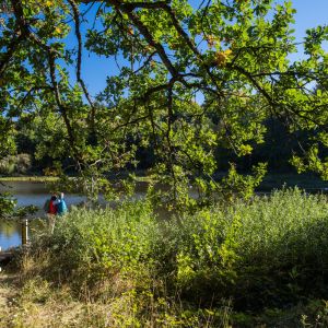
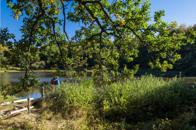
Blick auf den Windsborn Kratersee © Natur- und Geopark Vulkaneifel GmbH, Kappest
-
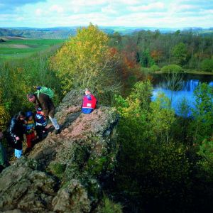
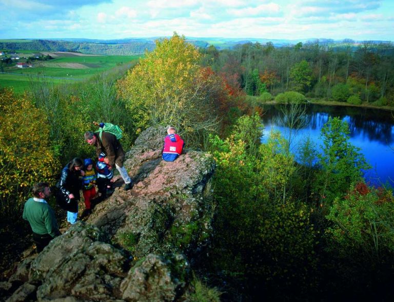
Schlackenfelsen am Windsborn © Natur- und Geopark Vulkaneifel GmbH
Geology
The Windsborn slag cone near Bettenfeld belongs to the Mosenberg row volcano group and is the fourth eruption site seen from the SE. It is separated from the other eruption sites by a distinct terrain depression and rises about 50 meters above the Devonian basement. Its crater now contains a lake with a siltation zone, surrounded by a rampart of slag. These were ejected glowing-hot from the volcano and then fused together as they cooled.
Special Features
Clearly visible around the lake are the slag deposits from which the mountain is piled up. The lake, with its siltation zone, is a special habitat for many rare plants and insects. In May/June, the fever clover produces countless white flowers on the lake's edge, and in June/July, the red-flowering bog bean delights us. Together with peat mosses, these plants, with their runner shoots, form a wide carpet that grows from the shore out onto the water surface of the lake. In the long run, the crater lake will silt up from the outside in and develop into a raised bog. In suitable weather, you can observe countless dragonflies and butterflies.
Location
Windsborn Crater Lake is located east of Bettenfeld.
.
Highlights Nearby
- Hinkelsmaar
- Meerfelder Maar
- Volcano Adventure Park Mosenberg
- Observation Tower Landesblick
- Manderscheid Castles
- Maar Museum Manderscheid
- Dreisborn
The Mosenberg with Windsborn Crater Lake is point 37 of the German Volcano Road.
Hiking Trails
around Windsborn Crater Lake
Explore the entire Mosenberg row volcano group on a circular route of about three kilometers. In addition to breathtaking nature, you will also find lots of information on the boards of the Geo-Route Manderscheid.
-

HeimatSpuren Mühlenpfad
Eine beschauliche Wanderung durch die malerischen Salmauen bei Eisenschmitt.
- Schwierigkeitsgrad:

- Strecke: 6,7 km -
- Dauer: 1:45 Std.
- Aufstieg: 27 hm -
- Abstieg: 39 hm
- Schwierigkeitsgrad:
-
HeimatSpuren Kraterseen Mosenberg
Rundweg bei Bettenfeld, der viele geologische Highlights bereithält.
- Schwierigkeitsgrad:
- Strecke: 5,1 km -
- Dauer: 1:30 Std.
- Aufstieg: 135 hm -
- Abstieg: 135 hm
- Schwierigkeitsgrad:
-

Andere Vulkaneifelpfade VulkaMaar-Pfad
Rundtour westlich von Manderscheid
- Schwierigkeitsgrad:

- Strecke: 27 km -
- Dauer: 8,5 Std.
- Aufstieg: 1022 hm -
- Abstieg: 1022 hm
- Schwierigkeitsgrad:
Guided Tours around the Crater Lake
- Lavaweg bei Deudesfeld
- Abenteuernacht: Fledermäusen auf der Spur
- Besinnen - bewegen - begreifen auf dem „Rundwanderweg „Schöpfung bewahren“
- Geschichtsstraße Kelberg - Wege zu Sichtbarem und Unsichtbarem
- Krimi-Wander-Tour: „Kerpener Mordsidylle“
- Sonntagsreihe: Pulvermaar
- „Verbrechen im Grünen – die Idylle trügt“
- Vom Maar zum Bergkratersee
- Frühstückswanderung „Der frühe Vogel fängt den Wurm“
Directions & Parking
East of Bettenfeld on the L16, there is a hiking parking lot between Windsborn Crater Lake and Hinkelsmaar.